How Resilient is the Jakarta Transportation Network?
"Have you ever wondered why Jalan Kramat Kwitang becomes so congested during rush hour, even though there are no large buildings with many workers?"
Abstract
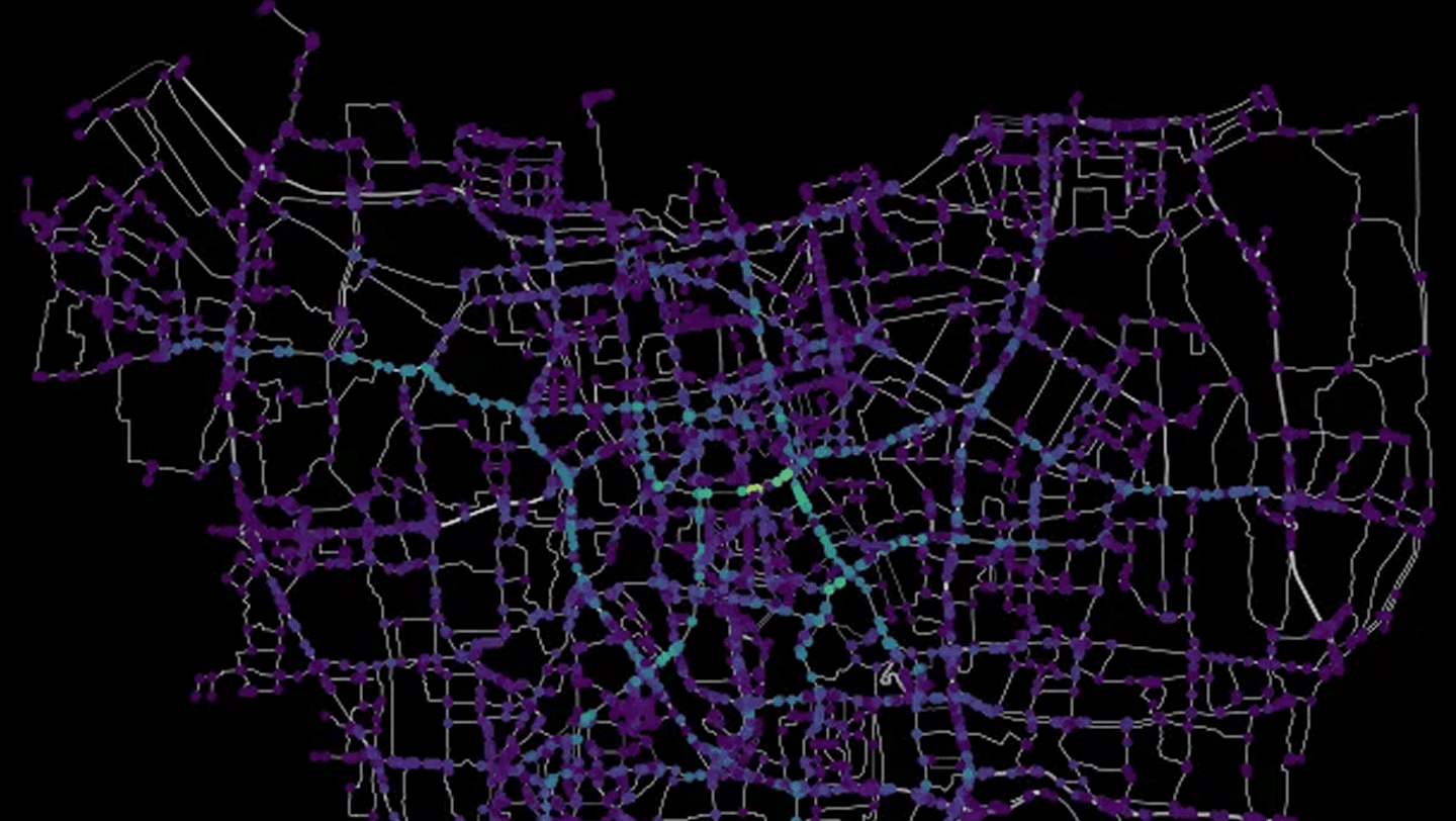
What happens to Jakarta if a major intersection fails? A flood, an earthquake, a single point of collapse—how much does the city break?
This analysis models Jakarta's transportation network as a graph, treating intersections as nodes and roads as edges. Using betweenness centrality, we identify which intersections carry the most weight—where the highest number of shortest paths converge. The answer: the intersection near Wisma Mandiri, through which 8% of all possible routes flow.
We then stress-test the network. Remove the most critical node. Recalculate. Remove the next. Repeat 40 times. The result: Jakarta's road network is not robust. Most eliminations produce statistically significant increases in travel distance—longer detours, more congestion, compounding delays.
Other findings: Jalan Kramat Kwitang's notorious traffic finally explained (8 of the top 10 critical intersections sit on that corridor). Jakarta splits into west and east under stress. And critically—only 7 of the 41 most important intersections are within 500 meters of a fire station.
The data is public. The methodology is reproducible. The implications are for the city to decide.